|
tween Ballinaskelling Bay and tne mouth of
Kenmare River, 4 m. from Hog’s Head.
Hogansburg, p.v. Franklin Co. N. Y.
Hogestown, p.v. Cumberland Co. Pa.
Hogue, Cape la, the N. W. point of Normandy
near which Admiral Rooke burnt 13 French
men of war, in 1692. Long. 1. 52. W., lat. 49.
45. N.
Hogenberg, an ancient castle of Suabia, in a
county of its name,now belonging to Wurtemberg;
situate near the source of the Necker, 10 m. S.
E. of Rothweil.
HohenUnden, a town of Bavaria, near which the
French gained a great victory ov.er the Austrians,
in 1800. It is 22 m. E. oT Munich.
Hoherdohe, or Holach, a district of Franconia,
abounding in wine, corn, wool, and cattle. It
now belongs to the kingdom of Wurtemburg.
The castle of its ancient counts stood close by
the village of Holack, near Uffenheim. The chief
town is Ohringen.
Hohenmaut, a town of Bohemia, on the river
Meyta, 13 m. E. of Chruddin.
Hohenstein, an ancient castle of Saxony, situ-
ate on a mountain, at the foot of which is the
village of Neustadt, 5 m. N. E. of Nordha^i-
sen.
Hohentwiel, a fortress of Wurtemberg,surround-
ed by the county of Nullenberg. Its fortifica-
tions were destroyed by the French in 1800. It
stands on a mountain, 9 m. E. N. E. of Scaff-
hausen.
Hohenzollem, a town of Germany, in a princi-
pality of the same name, with a castle on a moun-
tain the seat ofthe ancient counts of Hohenzollern.
It is seated on a branch*of the Neckar, 16 m. S.
by W. of Tubingen. Long. 9. 8. E., lat. 48.
28. N.
Hohnslein, a town of Saxony, on the river Mul-
da, 11 m. N. E. of Zwickau.
Hokesville, p.v. Lincoln Co. N. C.
Ho-kein, a city of China, of the first rank, in
the province of Pe-tcheli, situate between two
rivers, 85 m. S. of Pekino-. Long. 116. 23. E., lat.
38. 40. N.
Hola, a town of Iceland, and a bishop’s see, at
the mouth of a river, on the N. coast. Long. 19.
20. W., lat. 65.40. N.
Holbench, a town of Lincolnshire, Eng. with a
considerable trade in corn and wool. 12 m. S.
by E. of Boston, and 109 N. by E. of Lon-
don.
Holbeck, a sea-port of Denmark, in the island
of Zealand, with a good harbour, from which
great quantities of corn are annually exported. 30
m. W. of Copenhagen.
Holden, p.t. Worcester Co. Mass. 6 m. N. of
Worcester. Pop. 1,718.
Holdsicorthy, a town in Devonshire, Eng. seat-
ed near the canal from Bude harbour, between
two branches of the Tamer, 43 m. W., by N. of
Exeter, and 214 W. by S. of London.
Holderness, p.t. Grafton Co. N. H., on Squam
Lake. Pop. 1,409.
Hole in the WaU, a village of Talbot Co. Mary-
land.
Holland, an important province of the Nether-
lands, which has often given name to the Seven
United Provinces. It is divided into two parts,
North and South Holland; and is bounded on
the N. and W. by the German Ocean, on the E.
by the Zuyder Zee and the ci-devant state of
Utrecht, and on the S. by the Meuse, and Dutch
Brabant; extending from lat 51. 40. to 53. 1ft.
|
IjlTff |
|
lllllllll |
|
|
|
lllllllll |
llll|llll |
lllllllll |
lllllllll |
lllllllll |
lllllllll |
lllllllll |
lllllllll |
III1' ill' |
|
cm j |
2 |
3 |
4 |
5 |
6 |
7 |
8 |
9 |
1 |
0 1 |
1 1 |
2 1 |
3 1 |
4 |
|
N.; its longitude is about 180 m. E. of London.
It contains 90 walled towns, beside many others,
and above 400 villages. Before the Revolution
in 1796, six large cities had seats in the states
general; viz., Dort, Haerlem, Delft, Leyden
Amsterdam, and Gouda. The number of inhabi-
tants was estimated at 800,000. They also reach-
ed this number in 1801; but in 1817 they had
been reduced by the war to 748,000. The divi-
sions into the two governments of South and
North Holland was recognised by the constitu-
tion of 1814: the former contains 1,170 sq.m.
with 389,000 inhabitants, and is divided into the
six districts of the Hague, Leyden, Rotterdam.
Dort, Gorcum, and the Briel; while Holland
which in official papers, is called by its ancient
name of West Friesland, contains 930 sq. m.
with 359,000 inhabitants, and is divided into the
four districts of Amsterdam, Haerlem, Hoorn,
and Alkmaar. The whole province is a continu-
ed flat; and, but for the constant care in forming
ditches and canals, it wouldhe hardly "apable of
cultivation; some part of it lies even lower than
the sea, from which it is secured by dikes, 25 or
30 feet high, and as many broad at the top. The
climate is moist and variable, and in various
, places, particularly in North Holland, unfavora-
ble to health. The winters are severe, and the
rivers are almost every season rendered unnavi-
fable, for several weeks together, by the ice.
he soil is rich, consisting of a deep fat loam ;
but, owing to the humidity of both soil and cli-
mate, tillage is very limited. Wheat, madder,
tobaeco, hemp, and flax, are raised, but the chief
agricultural wealth of the country consists in
the pastures, which feed great number of cows;
the making of butter and cheese being a princi-
pal occupation. The meadows are generally un-
der water during the winter, and the inhabitants
only discharge them from it by mills adapted as
in the fenny parts of England to this particular
purpose.
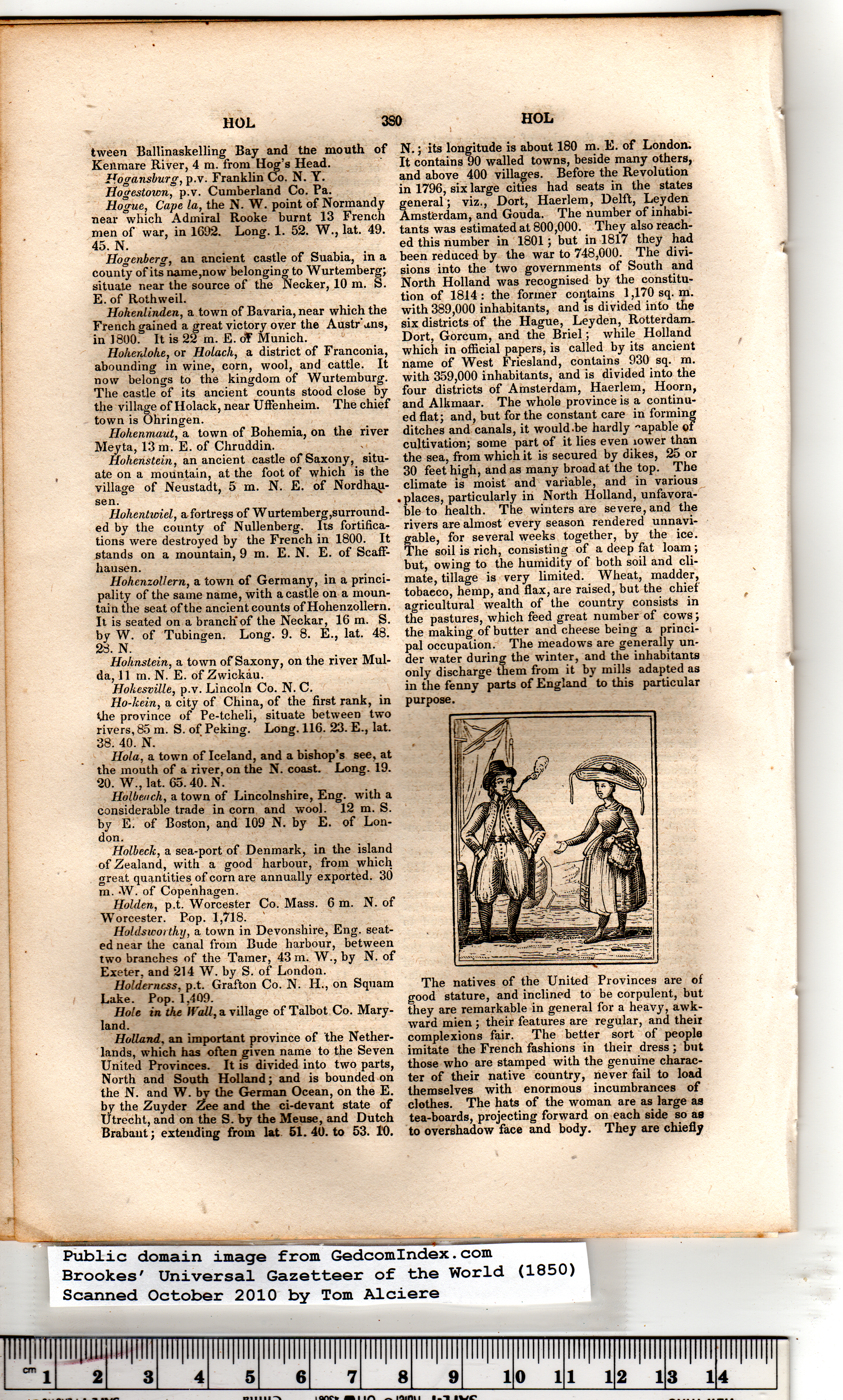
The natives of the United Provinces are of
good stature, and inclined to be corpulent, but
they are remarkable in general for a heavy, awk-
ward mien ; their features are regular, and their
complexions fair. The better sort of people
imitate the French fashions in their dress; but
those who are stamped with the genuine charac-
ter of their native country, never fail to load
themselves with enormous incumbrances of
clothes. The hats of the woman are as large as
tea-boards, projecting forward on each side so as
to overshadow face and body. They are chiefly |