|
Gazetteer of the State of Maine With Numerous Illustrations, by Geo. J. Varney
BOSTON: PUBLISHED BY B. B. RUSSELL, 57 CORNHILL. 1882. Public domain image from
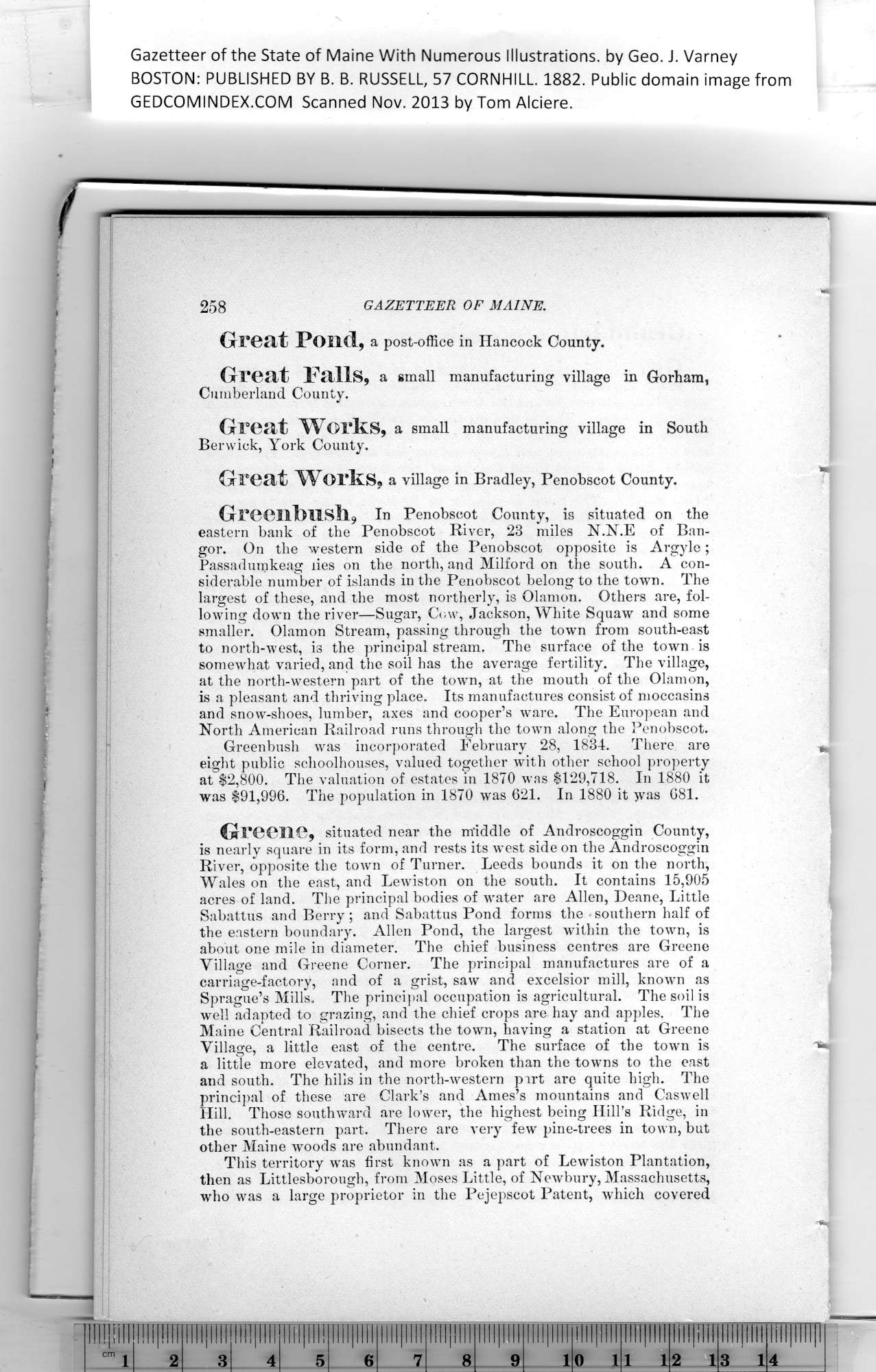
Great Pond, a post-office in Hancock County.
Great Falls, a small manufacturing village in Gorham,
Cumberland County.
Great Works, a small manufacturing village in South
Berwick, York County.
Great Works, a yillage in Bradley, Penobscot County.
Greenbnsll9 In Penobscot County, is situated on the
eastern bank of the Penobscot River, 23 miles N.N.E of Ban-
gor. On the western side of the Penobscot opposite is Argyle ;
Passadumkeag lies on the north, and Milford on the south. A con-
siderable number of islands in the Penobscot belong to the town. The
largest of these, and the most northerly, is Olamon. Others are, fol-
lowing down the river—Sugar, Cow, Jackson, White Squaw and some
smaller. Olamon Stream, passing through the town from south-east
to north-west, is the principal stream. The surface of the town is
somewhat varied, and the soil has the average fertility. The village,
at the north-western part of the town, at the mouth of the Olamon,
is a pleasant and thriving place. Its manufactures consist of moccasins
and snow-shoes, lumber, axes and cooper’s ware. The European and
North American Railroad runs through the town along the Penobscot.
Greenbush was incorporated February 28, 1834. There are
eight public schoolhouses, valued together with other school property
at $2,800. The valuation of estates in 1870 was $129,718. In 1880 it
was $91,996. The population in 1870 was 621. In 1880 it was 681.
Greene, situated near the middle of Androscoggin County,
is nearly square in its form, and rests its west side on the Androscoggin
River, opposite the town of Turner. Leeds bounds it on the north,
Wales on the east, and Lewiston on the south. It contains 15,905
acres of land. The principal bodies of water are Allen, Deane, Little
Sabattus and Berry; and Sabattus Pond forms the southern half of
the eastern boundary. Allen Pond, the largest within the town, is
about one mile in diameter. The chief business centres are Greene
Village and Greene Corner. The principal manufactures are of a
carriage-factory, and of a grist, saw and excelsior mill, known as
Sprague’s Mills. The principal occupation is agricultural. The soil is
well adapted to grazing, and the chief crops are hay and apples. The
Maine Central Railroad bisects the town, having a station at Greene
Village, a little east of the centre. The surface of the town is
a little more elevated, and more broken than the towns to the east
and south. The hills in the north-western part are quite high. The
principal of these are Clark’s and Ames’s mountains and Caswell
Hill. Those southward are lower, the highest being Hill’s Ridge, in
the south-eastern part. There are very few pine-trees in town, but
other Maine woods are abundant.
This territory was first known as a part of Lewiston Plantation,
then as Littlesborough, from Moses Little, of Newbury, Massachusetts,
who was a large proprietor in the Pejepscot Patent, which covered
PREVIOUS PAGE ... NEXT PAGE
This page was written in HTML using a program written in Python 3.2
|
